Data Collaborative on WASH in Malawi & DRC
About
Description
CartONG completed a project in December 2018 to improve the measurement of Sustainable Development Goals (SDGs) around health in DRC using crowd-sourcing and OpenStreetMap. The project was funded by the Global Partnership for Sustainable Development Data (GPSDD) and was led by 510/Netherland Red Cross and targeted to develop the data collaborative approach in two countries, in Malawi (510) on WASH data, and in DRC (CartONG) on health data. We implemented it in partnership with the OpenStreetMap DRC team. The goal was to improve the localization of SDG 3.8, and its first target indicator, which focuses on the coverage of essential health services.
The strategy to improve the measurement of these indicators was the following: first, to assemble the existing data with all local stakeholders and assess its quality. Then, improve it on at least one pilot area with a field mission. And finally, build analysis tools to make use of the collected and curated data for the measure of SDGs.
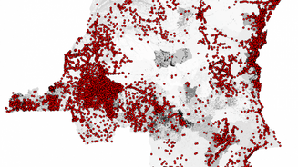
The project began with an inception workshop in Kinshasa, co-organized with the DRC Red Cross. The workshop allowed CartONG to assess the current landscape of health data and to identify a need to improve baseline data. The team then implemented actions such as supporting local stakeholders in sharing health data, gathering all existing data on health areas and health sites in DRC, and building and updating the RGC data model matching OpenStreetMap attributes.
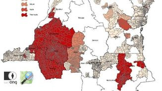
Two field pilots were conducted in partnership with the Intercluster and the Ministry of Health to test the possibility of quality data collection on both health sites and health area boundaries. The field pilots confirmed several challenges, including limited quality of existing health area boundaries and gaps in data collection.
The methodology used for health area delineation, based on direct feedback from local “infirmiers titulaires,” provided accurate results for a reduced cost and time invested. The data model for health sites proved adapted, with 50 health sites enumerated and directly uploaded in OpenStreetMap for analysis. An introduction to the mobile data collection method (KoBo Toolbox) was also presented to local MoH workers.
The collaborative work has proven successful in the field, with multiple actors involved and local MoH teams showing consistent interest in the approach and its deliverables. The data collected during the mission allowed for the creation of several analysis products, including paper maps analyzing the accessibility of health centers for the population and a prototype dashboard allowing dynamic and upgradeable analysis based on OSM data.
A second workshop was organized in July to present the advances made, gather feedback from stakeholders, and define the strategy for the finalization of the project.

