Emergency mapping for ACAPS
About
Description
CartONG has supported ACAPS in its mission to analyze and summarize humanitarian crises by participating in the cartographic representations of several of its projects.
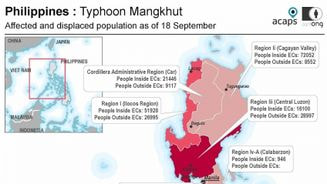
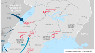
This was illustrated by CartONG’s support of ACAPS in the production of maps to illustrate the ACAPS Briefing Notes published when a new humanitarian crisis arose or an old one evolved. These illustrations helped, for example, to complement the bulletin by highlighting affected areas, hot spots, or key figures of a crisis.
Another specific support was provided In 2018 with a mission focused on 6 displacements and refugee crises (in Uganda, Syria, Afghanistan, Burundi, Democratic Republic of Congo and Nigeria), 4 natural disasters (volcanic eruption in Papua New Guinea, flood in Malawi, cyclone in Somalia and typhoon in The Philippines), 3 outbreak contexts (Lassa Fever in Nigeria, Cholera in Zimbabwe and Ebola in DRC) and during the Venezuelan crisis in September 2018.
Finally, in 2019, our team produced several maps for displacement in Burkina Faso, situation updates in Venezuela, security incidents in DRC, flooding in Nepal, and rainfall and food security in the Horn of Africa.

