GIS infrastructure in the Kutapalong refugee camp
About
Description

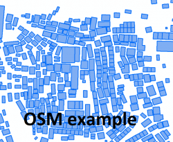
Since the beginning of the Rohingya crisis, CartONG – as part of the MSF GIS Centre – has provided continuous remote support to MSF for the implementation of a GIS system in the field. The main activities focused on implementing the system on cloud technology for the emergency phase and preparing the server architecture for the stabilization phase. In terms of database population, CartONG has also developed an automated workflow to extract OpenStreetMap data useful for operations. During a four-week on-site mission in the Kutapalong refugee camp,
CartONG assessed the existing architecture of the system and standardized the database model to move the GIS activities in the field from a state of emergency to a more stable one. CartONG stabilized the database schema so that the data could be migrated from the old format to the new one. To improve and automate processes, a comprehensive dataset inventory of the area was established and followed by a set-up of Data update parameters. This way, it was easier to integrate the newest data into the database.
As part of the stabilization of the project, the recruitment of a national GIS staff was launched to be permanently based in the camp to coordinate the GIS activities in the long run. CartONG staff also took the opportunity to network with other MSF operational centres (in particular MSF Spain and MSF Belgium who had expressed an interest in learning more about the system that had been set up) to better collaborate on the use of GIS for operational activities. Finally, CartONG staff also coordinated the data collection team and helped them to better organize their daily data collection in the field.

