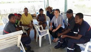
Support to the Malagasy volunteer firefighters
About
Description
Malagasy volunteer firefighters work on prevention (tree cutting, etc.), awareness-raising (first aid exercises and trainings, etc.), and assistance and reconstruction, but their capacity to deploy to rural areas was limited. The goal of the project, implemented in partnership with Pompiers Humanitaires Français (PHF) and the local OpenStreetMap community, was to improve Malagasy volunteer firefighters’ ability to respond by providing them with maps that would allow them to define their intervention areas and to deploy more easily when needed.
The first phase of the project consisted of the organization of several Missing Maps mapathons between October 2017 and February 2018 to prepare the OSM base map needed for the mission. As a result of this phase, a total of 60,000 buildings and 3,000 kilometers of roads and pathways were either added or updated on OSM – all data were then validated by CartONG volunteers.
This preparatory phase led to a field mission in Madagascar organized in March 2018, thanks to the support of the CNES (the French Space Agency). After a preliminary phase in Antananarivo with the Malagasy OSM community – during which a data-sharing workshop was organized – the combined CartONG & OSM-Mg team then left for the Atsinanana region to collect data in the field for 3 weeks.
Beyond data collection, CartONG could also raise awareness among local stakeholders such as the NGO Care International and the head of the topographic department of the Vatomandry district. Lastly, CartONG obtained local administrative information (such as administrative boundaries) which was then integrated into OSM.
The atlas produced was later transferred to PHF and local partners. Building on the success of this mission, CartONG has then conducted several projects in collaboration with OSM Madagascar.


